🎯 Decision-first design
Every feature is built around a business question, not a GIS workflow. You start with the decision, and GeoSense AI finds the signals that matter.
GeoSense AI is a next-generation geospatial platform that combines interactive maps, open data, enterprise connectors, and frontier AI models. Our mission is simple: make complex location analysis as easy as drawing an area on a map.
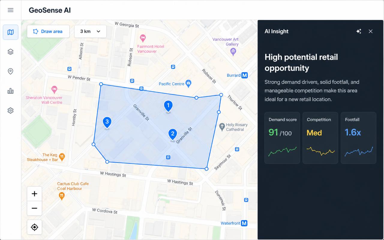
GeoSense AI turns raw geographic data into clear, actionable intelligence. Users draw or select any area on the map, layer public and private data sources, and receive AI-generated briefings that highlight opportunities, risks, and next steps — all in plain language.
The platform supports the full location-decision lifecycle: site selection and market analysis, risk assessment, logistics and route optimization, digital-twin operations with GeoTwin AI, and multi-source data visualization through GeoAnalytics.
Every feature is built around a business question, not a GIS workflow. You start with the decision, and GeoSense AI finds the signals that matter.
Insights are generated by leading frontier models and grounded in real geospatial data — not generic text.
Custom data, credentials, and sensor streams stay session-only unless you explicitly choose to persist them.
Connect PostGIS, ArcGIS REST FeatureServer, OGC WFS, and IoT/SCADA sources without moving data out of your environment.
A look inside GeoSense AI — every module runs on an interactive Google map with your own data layered on top.
Select an area, pick a sector context, and get an AI-written briefing with KPIs, risk flags, and opportunities tailored to retail, real estate, logistics, insurance, utilities, agriculture, and more.
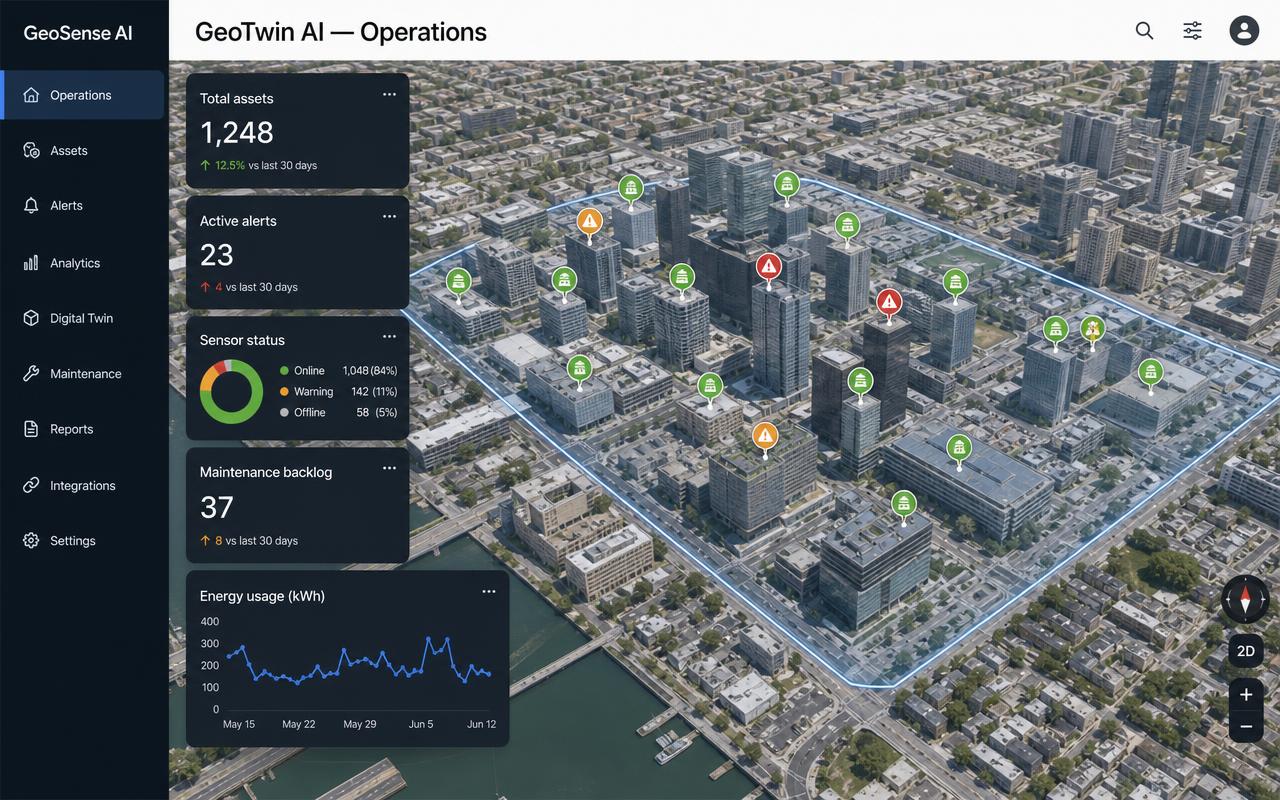
Build a live 3D twin of your physical estate. Register assets, attach sensors, define zones and floors, and monitor health, alerts, energy, and maintenance through an Operations Dashboard.
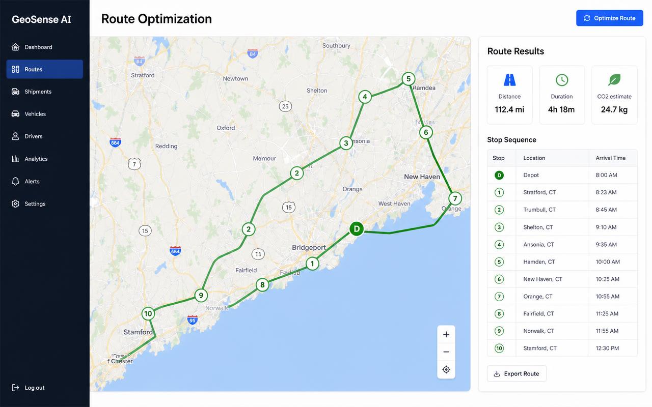
Solve multi-stop, multi-vehicle routing with real-time traffic, time windows, capacity, and driver shifts. Reduce mileage, fuel, and SLA breaches with one-click re-optimization.
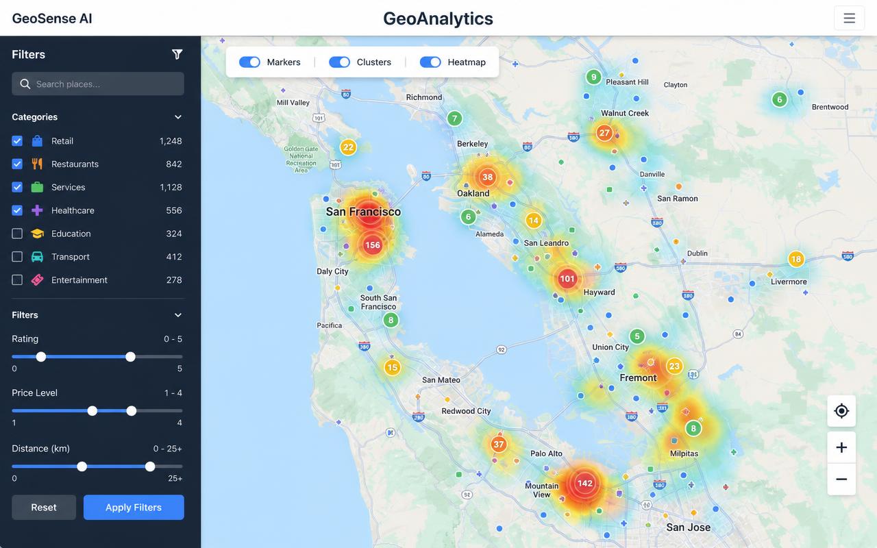
Visualize custom datasets, public layers, and REST-connected sources on Google or OSM maps with markers, clusters, dynamic filtering, and a dedicated analysis page.
See the platform in action, browse case studies, download the brochure, or request a custom demo.